Fallorado
A road trip through Colorado's fall color — and the history hiding inside it.
STORIES
Anna Sharp
4/6/20269 min read

We Had a Deadline
We had a deadline in New Mexico.
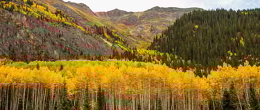
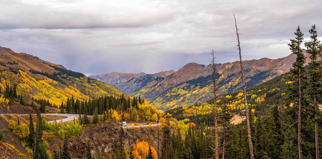
The Albuquerque International Balloon Fiesta was on the calendar, and Colorado was the road between here and there. But we'd heard about Colorado in fall our whole lives. The gold. The light. The way the aspens turn the whole state into something that doesn't look real.
We decided to take our time getting south. We dubbed the drive Fallorado. Because obviously.
What followed was one of the most layered stretches of travel we've done since hitting the road full-time. Beautiful in ways we expected. Heavy in ways we didn't.
Steamboat Springs and Explorist Live
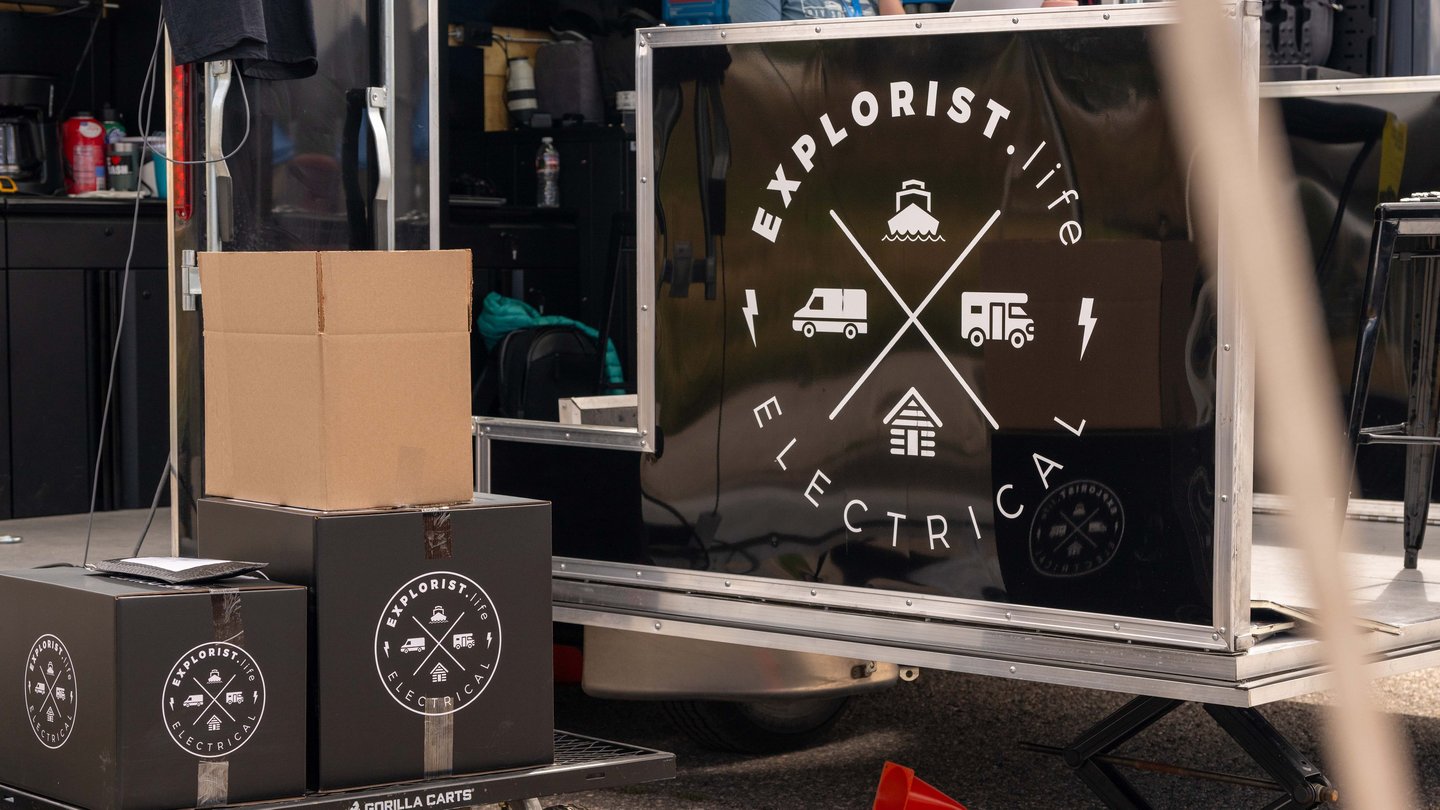

Our first stop was Steamboat Springs for Explorist Live — the first in-person event from Explorist Life.
If you've spent any time researching solar for your RV, you've probably already found them. Nate and his team have built one of the best resources out there for DIY off-grid electrical systems. Pre-assembled kits, detailed tutorials, and real support that makes the process actually make sense.
We run their system on our rig. It changed what full-time life looks like for us. Boondocking became a real option. We can run AC off-grid when we need to. Canada wouldn't have happened without it.
The event brought together live solar installs on real rigs, hands-on classes, and a community of people who just wanted to understand their systems better. The weather only cooperated some of the time, but the people were great. Small team. First rodeo. They delivered. We hope it's the first of many.
Rifle Gap State Park
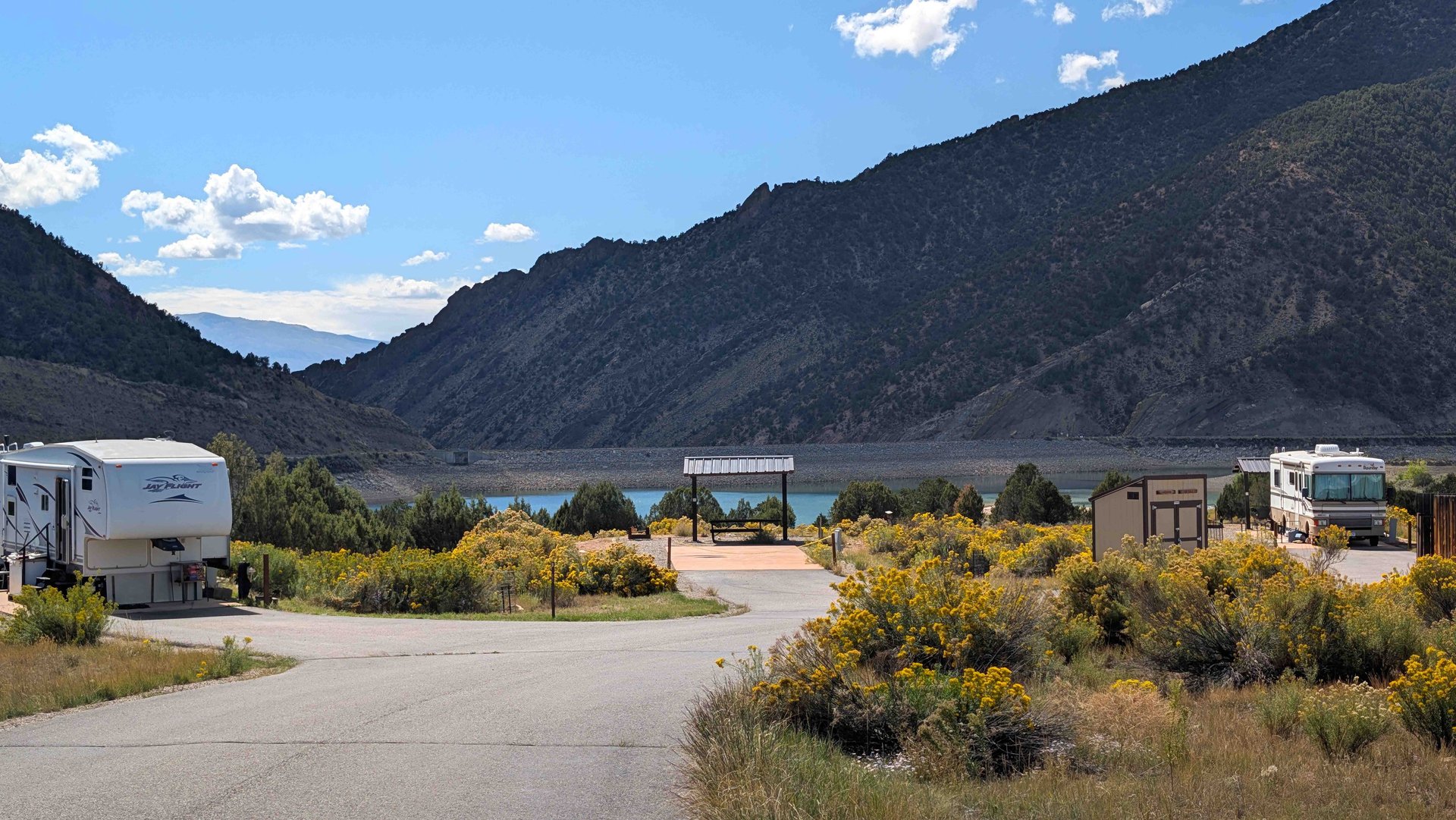
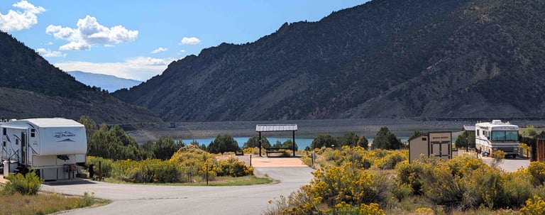
From Steamboat we headed south to Rifle Gap State Park — a quiet stop tucked into the canyon country west of Glenwood Springs.
We weren't expecting much. It turned out to be exactly the right base camp before one of the biggest surprises of the whole trip.
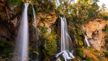
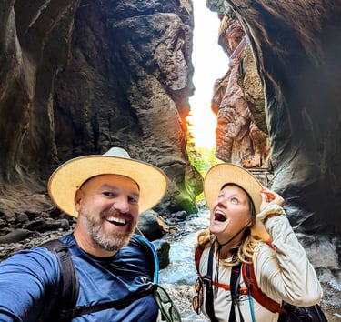
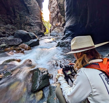
Rifle Falls
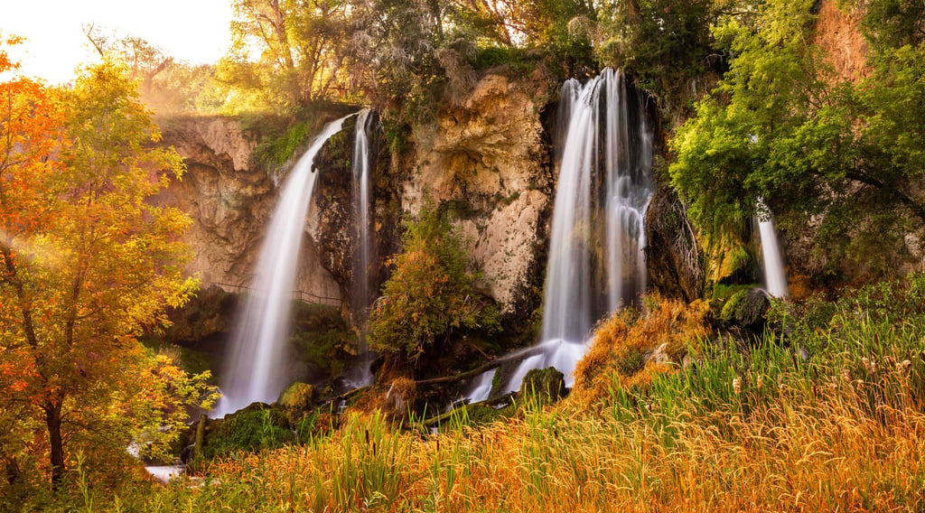
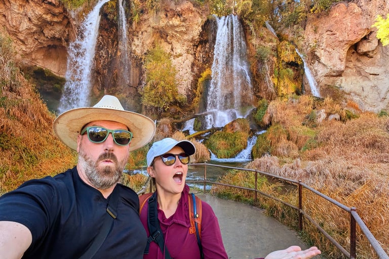
I'd seen photos of Rifle Falls online and I really wanted to check them out while we were in town. I'm so glad we did.
Rifle Falls State Park has been drawing visitors since 1884 — one of Colorado's earliest tourist destinations, back when ranchers were still breaking ground in the canyon country west of Glenwood Springs.
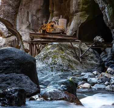
What makes Rifle Falls genuinely unusual is a decision made in 1910.
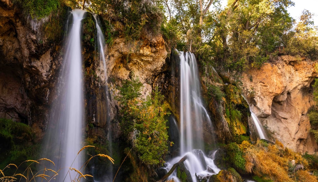
The town of Rifle needed electricity. Engineers looked at East Rifle Creek dropping over a limestone cliff and saw potential. They built a small hydroelectric station at the top of the falls and installed a pipe to divert part of the creek's flow through the turbines. That diverted water had to exit somewhere. It exits through its own channel in the cliff face, separate from the natural flow on either side of it.
One wide waterfall became three.

The plant powered the town for nearly fifty years. It was decommissioned in 1952, but the pipe was never removed. The concrete foundations and ironwork are still up there. The middle waterfall is still being fed by infrastructure installed over a century ago.
Two of the three falls are natural. The middle one is a piece of engineering that outlasted its purpose and has quietly become the most photographed feature of the park.
The cliffs themselves are travertine — calcium carbonate slowly deposited by mineral-rich water over centuries, built up layer by layer, possibly behind an ancient beaver dam. The caves you can walk into are believed to be remnants of a much larger underground cavern that collapsed over time.
For most of our visit, we had the place almost entirely to ourselves. It's the kind of thing that makes you wonder how more people haven't found it yet.
Over a hundred years of visitors, and it still feels like a secret.
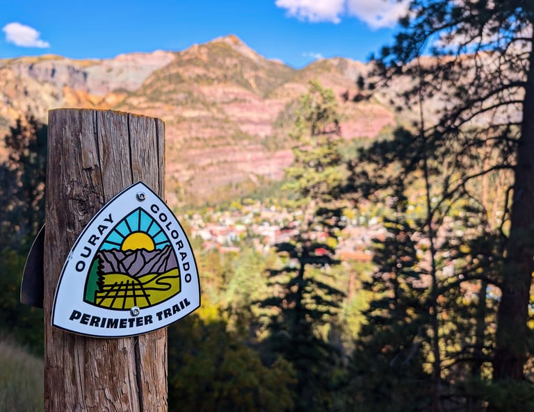
Ouray, Colorado
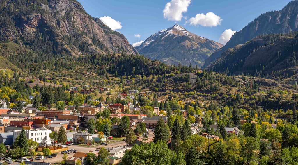
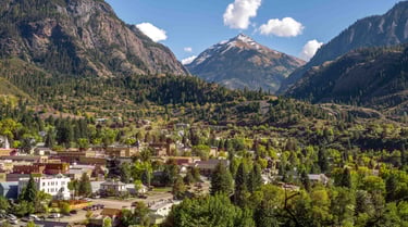
Multiple friends told us to go to Ouray. Friends who travel constantly and have seen most of the country. The kind of friends whose opinions carry weight.
Hot springs. World class hiking. Via ferrata. The Million Dollar Highway. Great food. All within walking distance of each other.
We didn't get to do everything and we can't wait to come back.
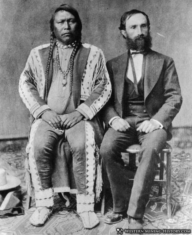
Chief Ouray and the Valley He Called Home
Long before the town of Ouray existed, this valley belonged to the Ute people.
They called it Uncompahgre. Their word for "hot water springs." Every summer, they traveled here to hunt, fish, and soak in their sacred miracle waters. The river running through the valley still carries that name. The town built on top of it carries a different one.
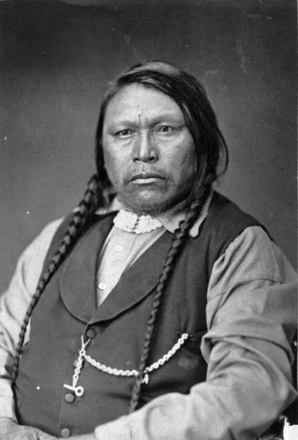
Chief Ouray was born in 1833, on a clear night lit by a meteor shower. The elders took it as a sign. In Ute, his name means "arrow." He grew up in Taos, far from his people, learning the languages of everyone around him. Ute, Apache, Spanish, English, sign language. Five languages by the time he was a young man. It made him the most useful person in the room when the United States government needed someone to negotiate with.
He came to Colorado around 1850 and joined the Tabeguache band, where his father had become a leader. When his father died in 1860, Ouray became chief of the band. That was the traditional path within his own people.
But the United States needed more than a band leader. They needed one person to speak for all the Utes. Ouray was the only one who could. So the government appointed him Chief of all the Utes, a title that carried enormous weight in Washington and almost none among many of the people he was supposedly leading. Other bands resented it deeply. He had been handed authority over them by the very government he was negotiating against.
He met with Presidents Lincoln, Grant, and Hayes. President Hayes called him "the most intellectual man I've ever conversed with." He was called "The Man of Peace," and he genuinely believed, that war with the whites would mean the end of his people. He'd seen how outnumbered they were. He chose diplomacy every time, even when it cost him.
And it cost him.
Other Utes called him a coward. His own brother-in-law tried to kill him with an axe. Treaty after treaty, he sat across the table and watched the land shrink. Each agreement was supposed to protect what remained. Each one gave away more. The government rarely honored what it promised.
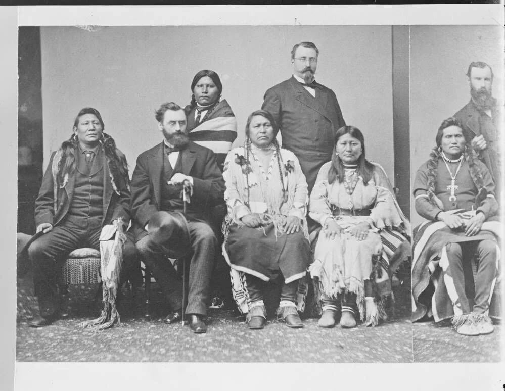
Chief Ouray died in 1880, at 47, on a trip through southwestern Colorado. Still trying, one last time, to negotiate an agreement that would let his people stay. His wife Chipeta, who had traveled with him to Washington and sat on tribal councils, outlived him by 44 years, living in near poverty. The US government never fully paid what it had promised her.
When the Uncompahgre Utes were finally forced from Colorado, more than 1,000 US troops marched behind them on the 350-mile journey to a reservation in Utah.
The town built in this valley, on land the Ute had called sacred for centuries, but were exiled from, was named after him. It's a complicated thing to sit with.
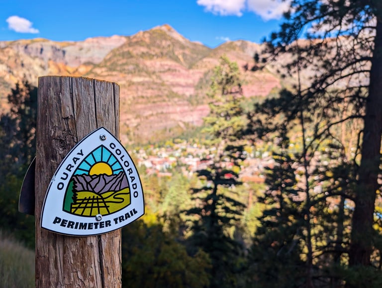
The Ouray Perimeter Trail
The Ouray Perimeter Trail loops 5.5 miles around the town at elevation. The views are the whole point.
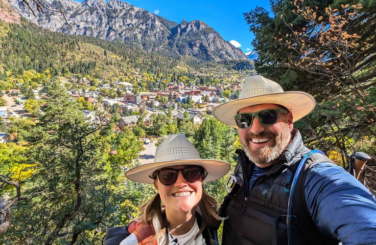

From up there, Ouray looks exactly like what it is — a small Victorian mining town dropped into the bottom of a natural rock amphitheater, ringed on three sides by mountains that don't care how beautiful they are. The trail hugs cliff faces, passes waterfalls, and crosses bridges over gorges. At several points you look straight down into the valley where the Uncompahgre River runs through town below. In fall, with the aspens turning and the red canyon walls lit up against a blue sky, it's one of the more beautiful hikes we've done.
We made it about a third of the way around before we ran into another couple coming from the other direction. They asked if we'd been to Box Canyon yet.
We had not.
They told us we needed to go. Right now. And then they turned around and walked back down with us to show us the way in.
That is one of our favorite things about this life. Strangers become guides without being asked.
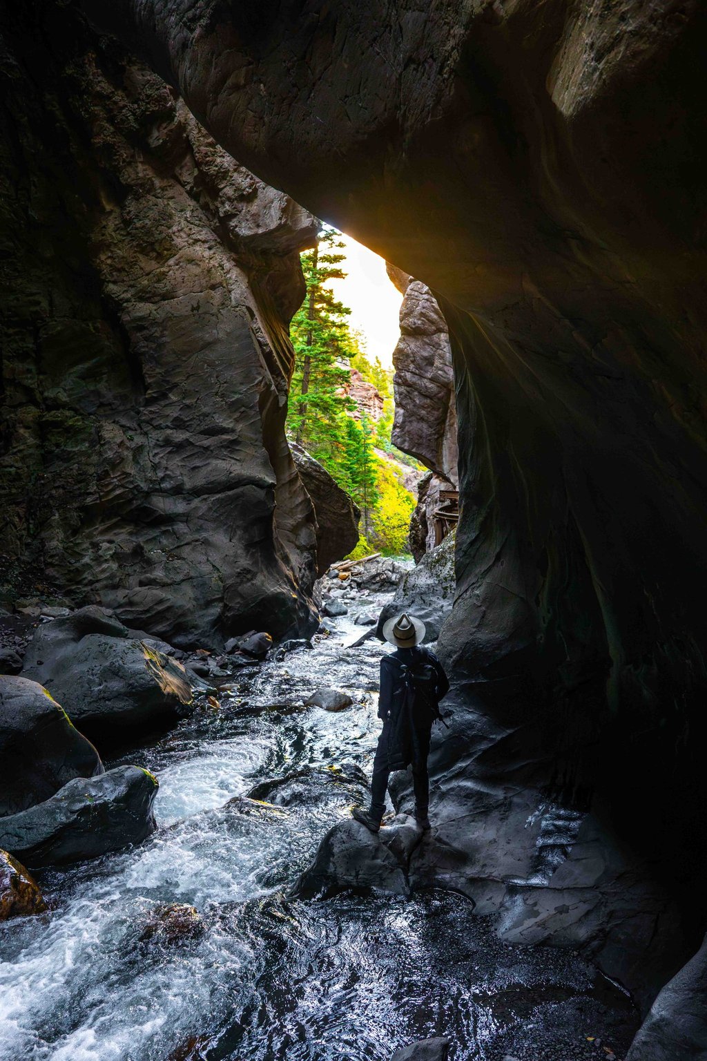
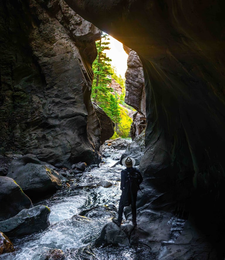
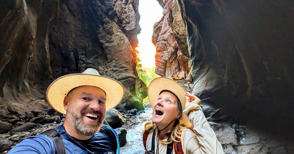
Box Canyon & Box Canyon Falls
Box Canyon sits right at the edge of town. We wouldn't have found it without the couple on the trail.

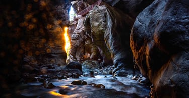
You hear it before you see it.
Canyon Creek drops 285 feet through a slot barely ten feet wide, and the sound fills the canyon completely. Standing at the base, you feel it in your chest. If you stepped into that water, you would not step back out.
The canyon walls are nearly 1.7 billion years old — some of the oldest exposed rock on the continent. Light reaches the bottom in thin gold lines, the way it does in places that don't get much sun.
In the 1870s, gold and silver prospectors made camp here. The canyon's flat floor and shelter from the elements made it the obvious place to settle, but those early miners nearly starved their first winter, cut off from supply routes by the same mountains they were trying to dig through. What they left behind is still on the canyon floor. Rusting quietly in the water.
We don't know much about their lives. Just what remains.
In another century, even that may be gone, but Canyon Creek will still be here, cutting through the same walls it always has.
The Million Dollar Highway
We'd planned to drive the rig from Ouray to Mancos via the Million Dollar Highway. We took the truck out first to see what we were dealing with.
That was enough.
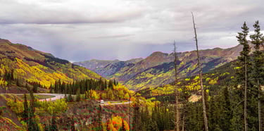
The Million Dollar Highway runs 25 miles between Ouray and Silverton, through the Uncompahgre Gorge and over Red Mountain Pass at 11,018 feet. It is widely considered one of the most scenic and most dangerous drives in North America.
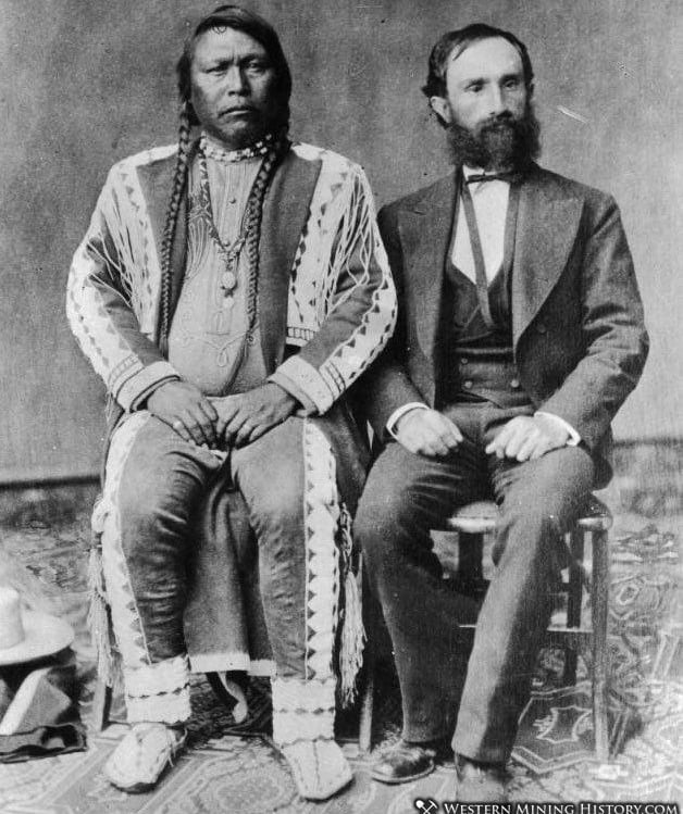
The road was built in 1883 by Otto Mears — a figure worth knowing. Born in Russia, orphaned young, he came to America, fought in the Civil War, and eventually made his way to Colorado as a wheat farmer. What he figured out quickly was that there was more money in connecting the mines than actually mining them. He became a road builder, buying a controlling stake in a struggling toll road company and putting crews to work blasting the route directly from solid rock. For nearly thirty years after it was built, the road belonged entirely to horses and mules, hauling silver and gold ore down the mountain and supplies back up.
The highway has been open to vehicles since 1924. The origin of the name is disputed. Some say the fill dirt used during improvements contained a million dollars in gold ore. Others say it cost a million dollars a mile to build. Either way, the name stuck.

There are no guardrails on much of the highway. Not by accident. Snowplows need somewhere to push the 300 inches of annual snowfall that falls on the San Juans. Large rigs can and do drive it. No permits. No restrictions. Just two lanes, no guardrails, and your own nerve. The road was built for mules hauling ore but has been accommodating large vehicles for over a century. Whether you decide yours should be one of them is entirely up to you.
We found a different route.
Watch the Full Episode

These mountains have a way of making you feel like you're always leaving too soon.
See you out there.
— Anna