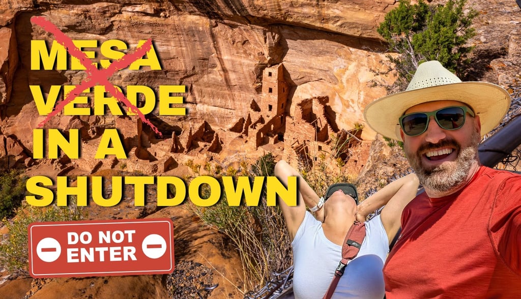
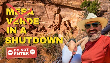
Mesa Verde Without a Plan: What a Government Shutdown Taught Us About Showing Up Anyway
A comprehensive guide to Mesa Verde National Park, including the self-guided route we followed after a government shutdown scrapped our tour plans, the history of the Ancestral Pueblo people, and everything you need to know before you visit.
TRAVEL GUIDES
Anna Sharp
4/20/202612 min read
We had been planning this visit for months.
Route mapped. October 1st circled on the calendar. Mesa Verde had been on our list since before we even hit the road full-time, and we were finally close enough to make it happen. We planned to book our tour tickets a few days out, the way we usually do.
Then we found out the federal government was most likely shutting down the day after we arrived. We were cautiously optimistic: go that evening, see what we could, and hopefully the government would reopen in a day or two so we could come back for the tours.
Turns out it was the longest government shutdown in history.
If we had waited, we would not have gotten in at all.
Instead, we went after work on September 30th with no reservations, no guide, and a route we got from AI.
As we say in RV life: pivot and smile, baby!
What Mesa Verde Actually Is
Mesa Verde National Park sits in the southwest corner of Colorado, near the town of Cortez. It protects over 4,700 archaeological sites, including more than 600 cliff dwellings built by the Ancestral Pueblo people between roughly 550 and 1300 CE.
This is one of the most significant archaeological sites in North America. The park was established in 1906 as the first national park created specifically to protect the works of people rather than natural landscapes. It became a UNESCO World Heritage Site in 1978.
The name comes from the first Spanish explorers to the area, who called it Mesa Verde, or "green table," for the lush mountain shrublands and pinyon-juniper forests that covered the region. Geologically speaking, it is not actually a mesa at all. It is a cuesta, meaning it tilts rather than sitting flat.
That 7% south-facing tilt turned out to be one of the reasons the Ancestral
Pueblo people chose it. The growing season there was up to 20 days longer than in surrounding valleys. Cold air flows down the slope at night, keeping the surface warmer and wetter than lower areas. They didn't just settle here by chance.
Getting There and What to Expect
The park entrance is about four miles east of Cortez on Highway 160. From the gate, the visitor center is just inside, but here is something worth knowing before you go.
The cliff dwellings are another 23 miles past the visitor center, deep into the mesa. That is a 45-minute drive just to reach the main archaeological area. Factor that into your planning, especially if you are arriving in the afternoon.
RV and van travelers: parking is available at the visitor center for smaller rigs. Class C and van-sized vehicles can park there comfortably. For larger fifth wheels or Class A rigs, check current NPS guidance before heading deeper into the park, as some of the loop roads have length restrictions. Note that the road to Long House on Wetherill Mesa prohibits vehicles over 25 feet entirely.
The visitor center is also where you will find the Chapin Mesa Archeological Museum, the passport stamp, and a tunnel replica near the entrance. The tunnel is a scaled model of the actual entrance openings into some of the cliff dwellings. Small by design. Built that way for defense. Ben's broad shoulders had thoughts about that.
The People Who Built It
About 1,500 years ago, long before Europeans explored North America, the people who would become the Ancestral Pueblo people chose this mesa for their home.
Historians and archaeologists used to call them the Anasazi, a Navajo word sometimes translated as "the ancient ones." The park now uses Ancestral Pueblo people to reflect their contemporary descendants, which is the right call. These are not a vanished people. Their descendants are alive and connected to this place today.
For more than 700 years, the Ancestral Pueblo people lived and farmed on the mesa. They grew corn, beans, and squash on the mesa tops. They hunted game and gathered native plants, including pinyon nuts in the fall, a tradition that continues among Pueblo people today.
Corn was central to everything. The park signs put it plainly: the story of corn is the story of the Pueblo people. A single kernel could yield hundreds. Stored properly, corn retains viability as seed for 70 years. The people at Mesa Verde stored three to five years' worth at a time. That is not just survival, that is deep institutional knowledge passed down through generations.
Before pottery existed, they made watertight baskets from yucca coated with pinyon pine sap or clay, then dropped fire-heated rocks inside to boil water and cook food. That eventually led to clay cooking pots. The progression took centuries.
The Turkey Story
This is the detail that we absolutely loved, and it deserves its own section.
The Ancestral Pueblo people domesticated turkeys. They kept them in pens, let them roam villages, fed them the same corn they depended on for survival. For over a thousand years, they did not eat them.

The turkeys were companions. They were providers. A single bird could yield 600 feathers annually, harvested painlessly as the bird molted. Turkeys are the only bird from which feathers can be taken without drawing blood. Those feathers were woven with yucca fiber into blankets. One blanket could require more than 11,000 feathers. Researchers believe it is likely that every member of an Ancestral Pueblo community, from infants to adults, had one. At high altitude, in a desert that gets genuinely cold at night, that blanket was survival.
They also buried their turkeys whole. Researchers have found ceremonial arrangements of complete turkey remains under plazas and alongside kiva closings. These were not livestock. They were individuals important to the household.
It was not until around 1100 to 1200 CE, as the population grew and mule deer became scarce from overhunting, that turkeys became a food source for the first time. By then, the relationship between the Pueblo people and their birds had already lasted over a thousand years.
The Cliff Dwellings and Why They Came Last
For most of the 700 years the Ancestral Pueblo people lived at Mesa Verde, nobody was building into cliffs.
They lived on the mesa top. They farmed terraced plots on the south-facing slopes, where the growing season ran up to 20 days longer than in the surrounding valleys. They built check dams to pool rainwater near their crops. The sandstone was porous enough that water pooling behind a dam would drain through the rock and drip into alcoves below, a passive irrigation system that also happened to keep the cliff dwellings supplied with water. These people understood the geology of this place at a level that most modern visitors never think about.
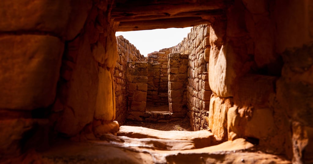
The cliff dwellings came in the final century of their time here, roughly 1190 to 1300 CE. The structures were built using sandstone blocks cut and shaped with river rocks, then sealed with clay mortar and chinking stones. Walls were plastered and painted. The work was precise. Buildings rose two and three stories inside alcoves that were already naturally sheltered from rain, snow, and temperature extremes.
The kivas, the circular underground chambers built into the floors of the dwellings, evolved directly from the pit houses the Ancestral Pueblo people had lived in centuries earlier. As the architecture changed, the kiva held its shape and its meaning. It was the one constant across all the changes, a ceremonial and social space that every family had access to, built at the center of everything.
Why they moved from the mesa top into the cliffs in those final decades is still debated. Defense is the most cited reason. Climate stress is another. Some archaeologists point to evidence of conflict, kivas burned deliberately, sites abandoned under duress. Others think the cliff alcoves offered practical advantages that finally outweighed the difficulty of living in them. The honest answer is nobody knows for certain. What the structures themselves tell you is that these were not desperate last-resort shelters. They were carefully built, intelligently positioned, and meant to last.
They did last. Eight hundred years and counting.
The Three Major Tours
(What We Missed and Why You Should Book Them)
The three main guided tour sites are Cliff Palace, Balcony House, and Long House. All three require ranger-led tours with tickets purchased in advance at recreation.gov. Tickets become available 14 days before your visit. During peak summer season you may only be able to choose between Cliff Palace or Balcony House on a given day, not both. Long House can be combined with either. All three close during winter months.
A few things worth knowing before you book:
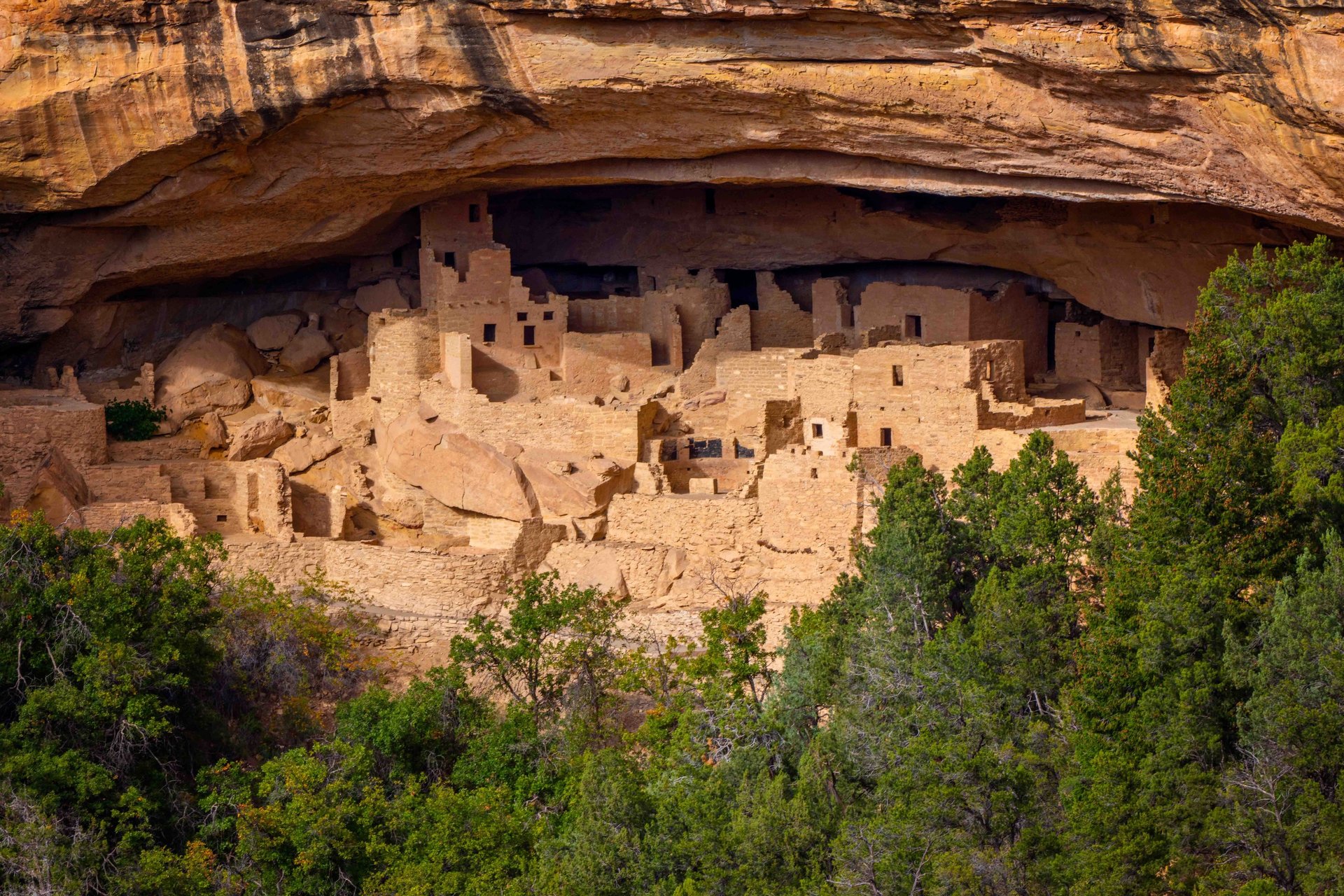
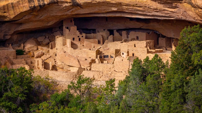
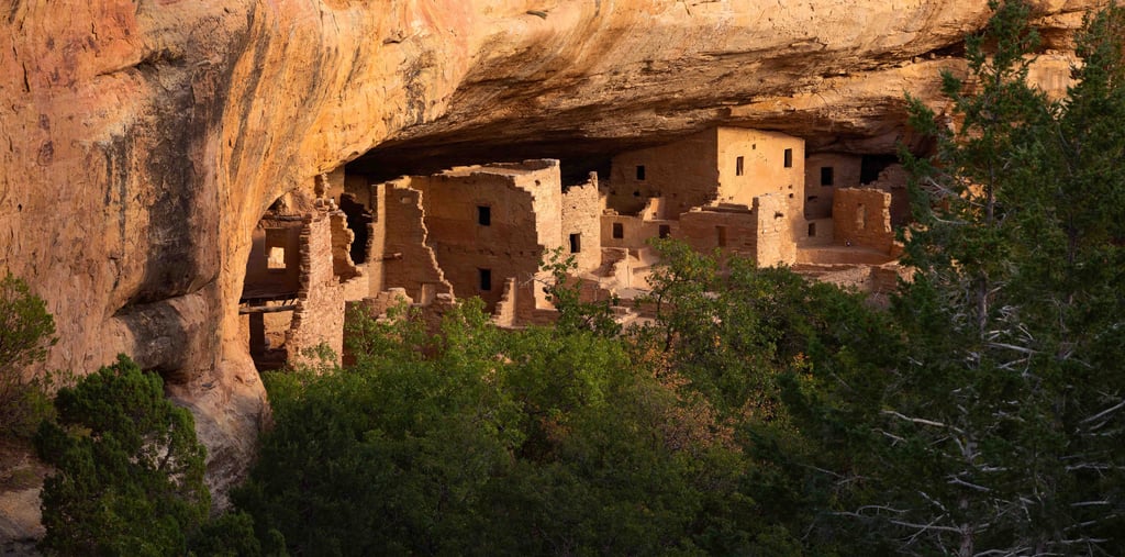
Cliff Palace is the largest cliff dwelling in North America, with 150 rooms, 23 kivas, and a population of approximately 100 to 150 people. The tour is one hour and is strenuous. It involves a 100-foot descent on uneven stone steps, climbing 8 to 10-foot ladders, and a 100-foot vertical climb to exit the site. It begins 23 miles from the visitor center, so allow an hour of driving time. Many believe Cliff Palace functioned as a social or administrative center and gathering place for ceremonies rather than a purely residential dwelling.
Balcony House is widely considered the most adventurous tour in the park. Built around the same time as Cliff Palace, it contains 38 rooms, two unusually deep kivas, and deliberately precarious access from the canyon bottom or mesa top. The tour is one hour. Participants climb a 32-foot ladder to enter, crawl through a 12-foot tunnel that is 18 inches wide, and exit by climbing a 60-foot open rock face using handholds and stone steps. It begins 25 miles from the visitor center. If you have any hesitation about ladders, heights, or small spaces, this is the one to think carefully about.
Long House is the second largest cliff dwelling in the park, with 160 rooms and 21 kivas. It sits on Wetherill Mesa, a 29-mile drive from the visitor center. Allow an hour and fifteen minutes for that drive. The tour is two hours and involves climbing two 15-foot ladders. Vehicles over 25 feet are prohibited on the road to Wetherill Mesa. Long House is notable for its seep springs along the back of the alcove, which provided a steady water source, and for what may be the largest great kiva in the park, likely used as a ceremonial gathering space similar to plazas found in Pueblo villages today.
All three tours are strenuous and take place at approximately 7,000 feet elevation. They are not recommended for anyone with heart or respiratory problems or other physical limitations.
We hope to go back and do all three.
The Route We Actually Did: Five Stops in an Afternoon
We used ChatGPT to build our self-guided afternoon route. We gave it our parameters: arriving after 3 PM, no tour tickets, no reservations, wanting to see as much as possible and catch good light at each stop. It built a solid agenda that accounted for light direction at each location throughout the afternoon. Here is how it played out.
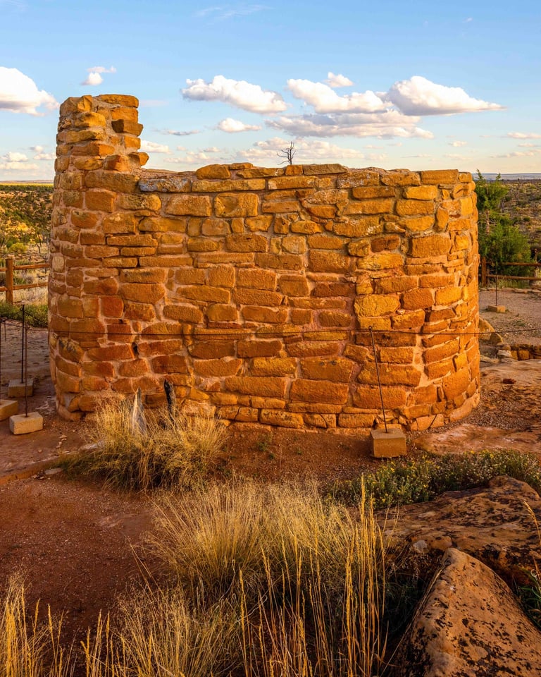
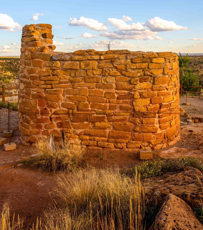
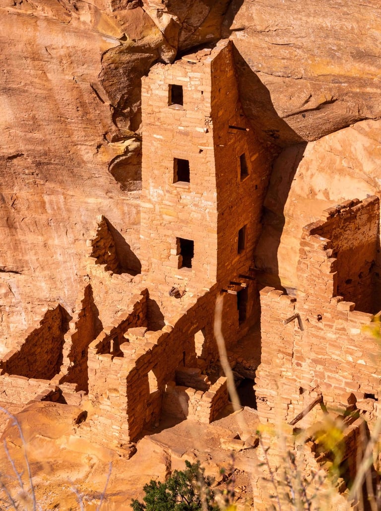
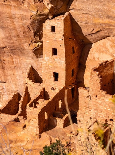
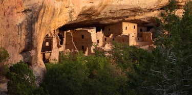
Stop 1 — Square Tower House Overlook
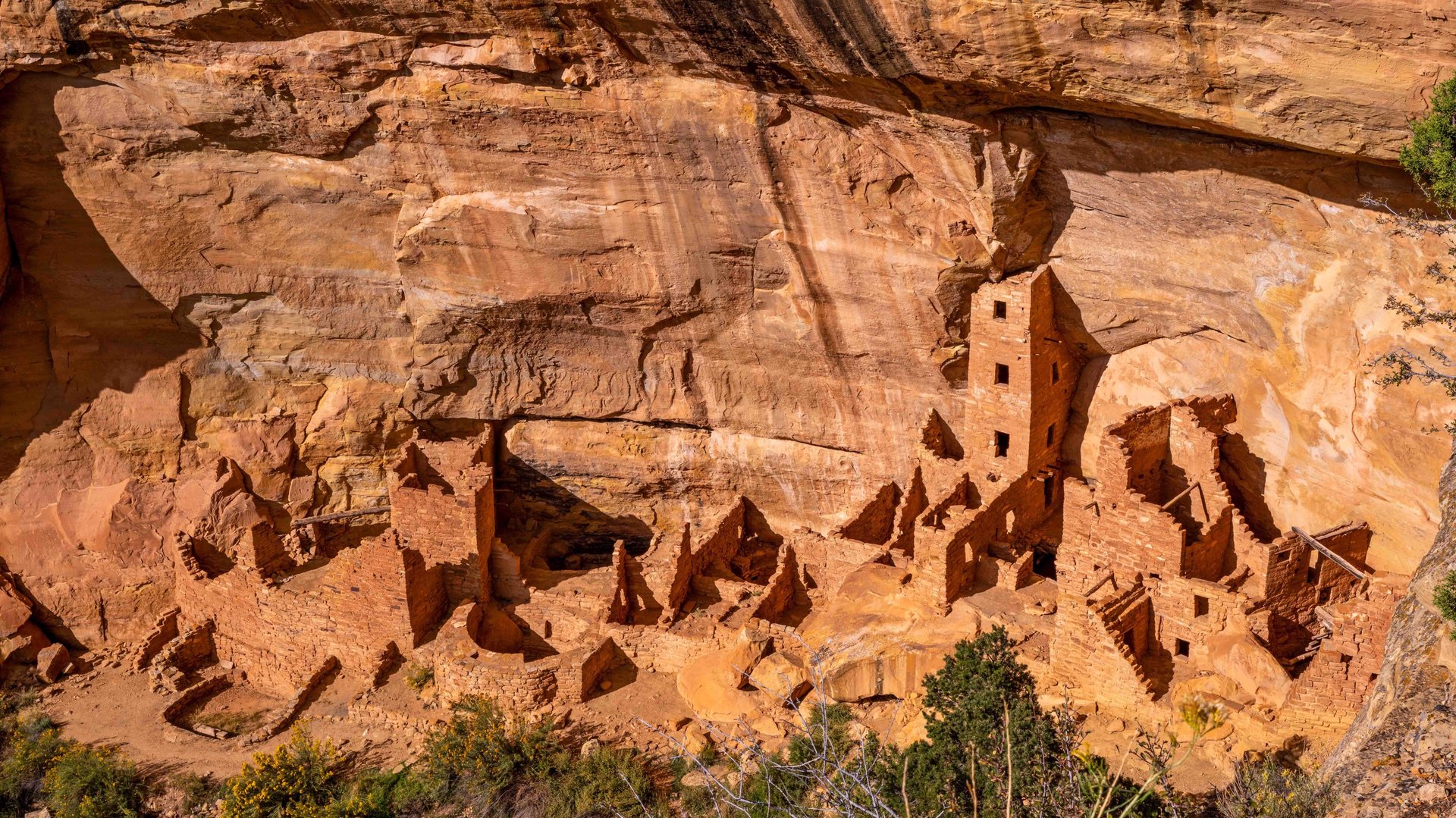
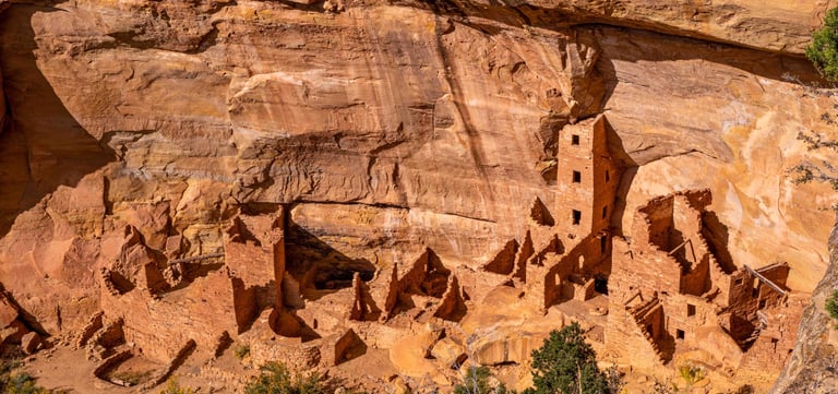
Square Tower House is the tallest structure in Mesa Verde, believed to have served as a watchtower or defensive structure, built into an alcove in the west wall of Chapin Mesa. You view it from an overlook above, which gives you an extraordinary perspective on the full scale of the dwelling.
Eight hundred years ago, someone made the same calculation every good builder makes. High enough for the vantage. Solid rock at your back and water nearby.
From the overlook you can see the circular kiva depressions in the floor. You can trace the logic of the whole settlement, where the water ran, how the valley opened up, why exactly here and not fifty yards in either direction.
Stop 2 — Sun Point View and Overlook
No trails down. No access. Just a flat outcropping at the canyon's edge and an entire civilization laid out in front of you.
At the civilization's peak in the mid-1200s, the Mesa Verde region had a population of around 30,000 people across the Montezuma Valley. More than live there today. They had trade networks reaching into Mexico. They tracked the movements of the sun and built their structures around it.
Sun Point sits at the edge of Chapin Mesa where the Mesa Top Loop makes its sweeping turn. From here, you can see into eight separate cliff dwellings at once, including Cliff Palace, Sunset House, Mummy House, and Oak Tree House.
Stop 3 — Sun Temple
Sun Temple is the outlier. It sits on the mesa top, not in a cliff face, and it does not look like the other structures. D-shaped, thick-walled, no rooms for living or storage. Archaeologists think it may have been ceremonial or astronomical because it aligns with solar events. It was never finished and nobody knows why they stopped.
This is also where our fuel light came on. We have a very large tank and even at empty we carry about 15 gallons. Still. When you are 23 miles deep into a national park and the fuel light comes on, it will spike your anxiety.
We were fine.
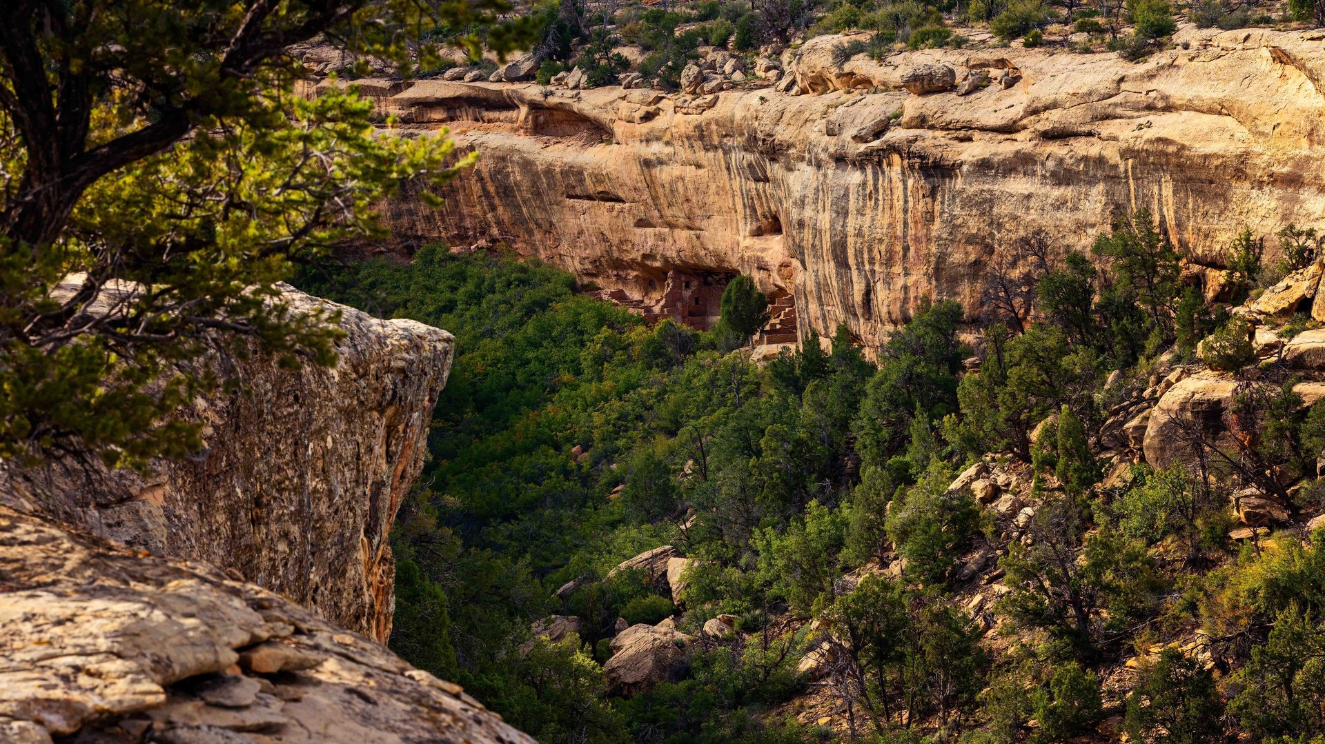
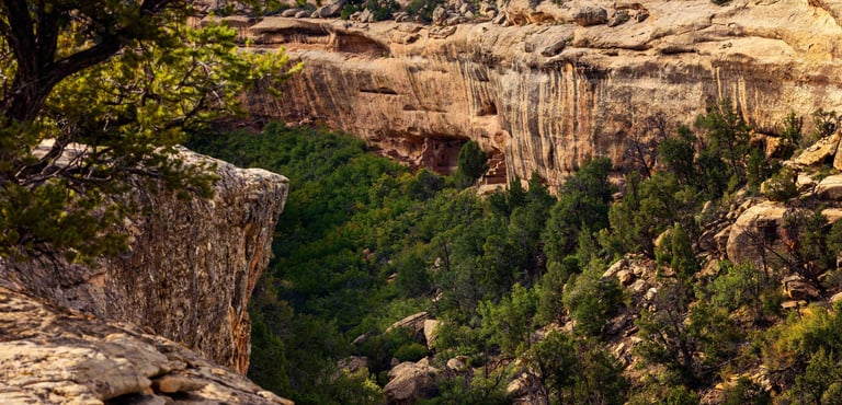
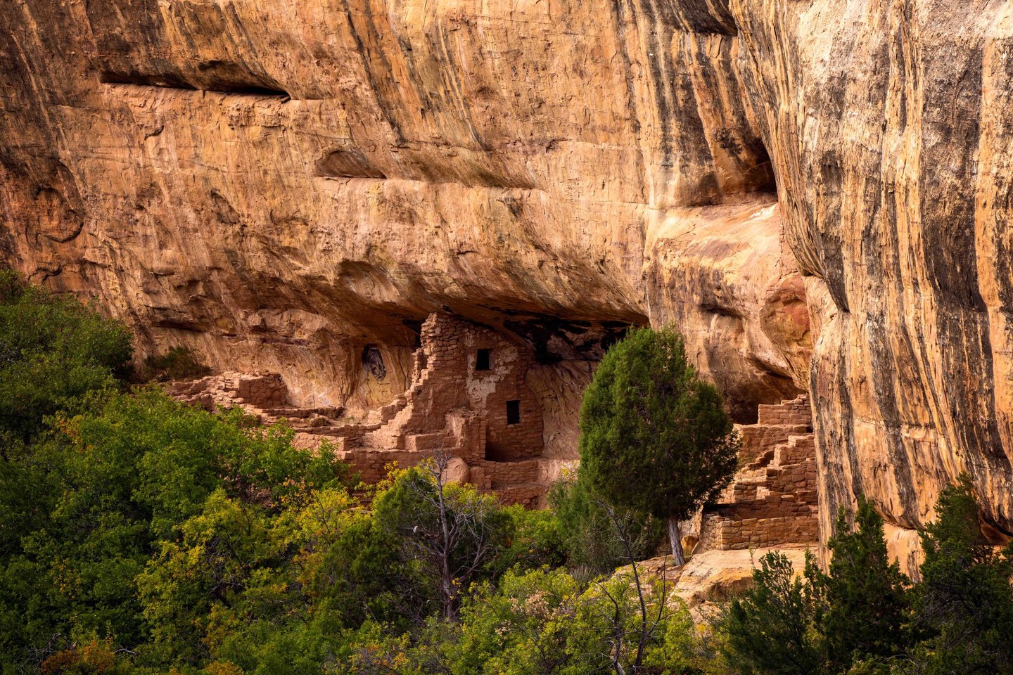
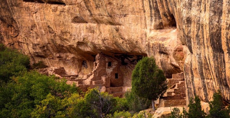
Stop 4 — Spruce Tree House Overlook
Spruce Tree House was once the most visited cliff dwelling in the park. Built in the 1200s, while Europe was fighting the Crusades and Genghis Khan was rewriting the map of the world, it is so well preserved under its natural alcove that it barely changed in 700 years.
It has been closed since 2015.
The sandstone arch above the dwelling began to crack that year. A climbing team went in, removed 60 cubic feet of unstable rock, and found evidence that more rockfalls were likely. The park closed the site and has not reopened it. Not for visitors, not for rangers, not for anyone. They are working on a stabilization plan involving LiDAR mapping and precision engineering, but it is a complicated problem.
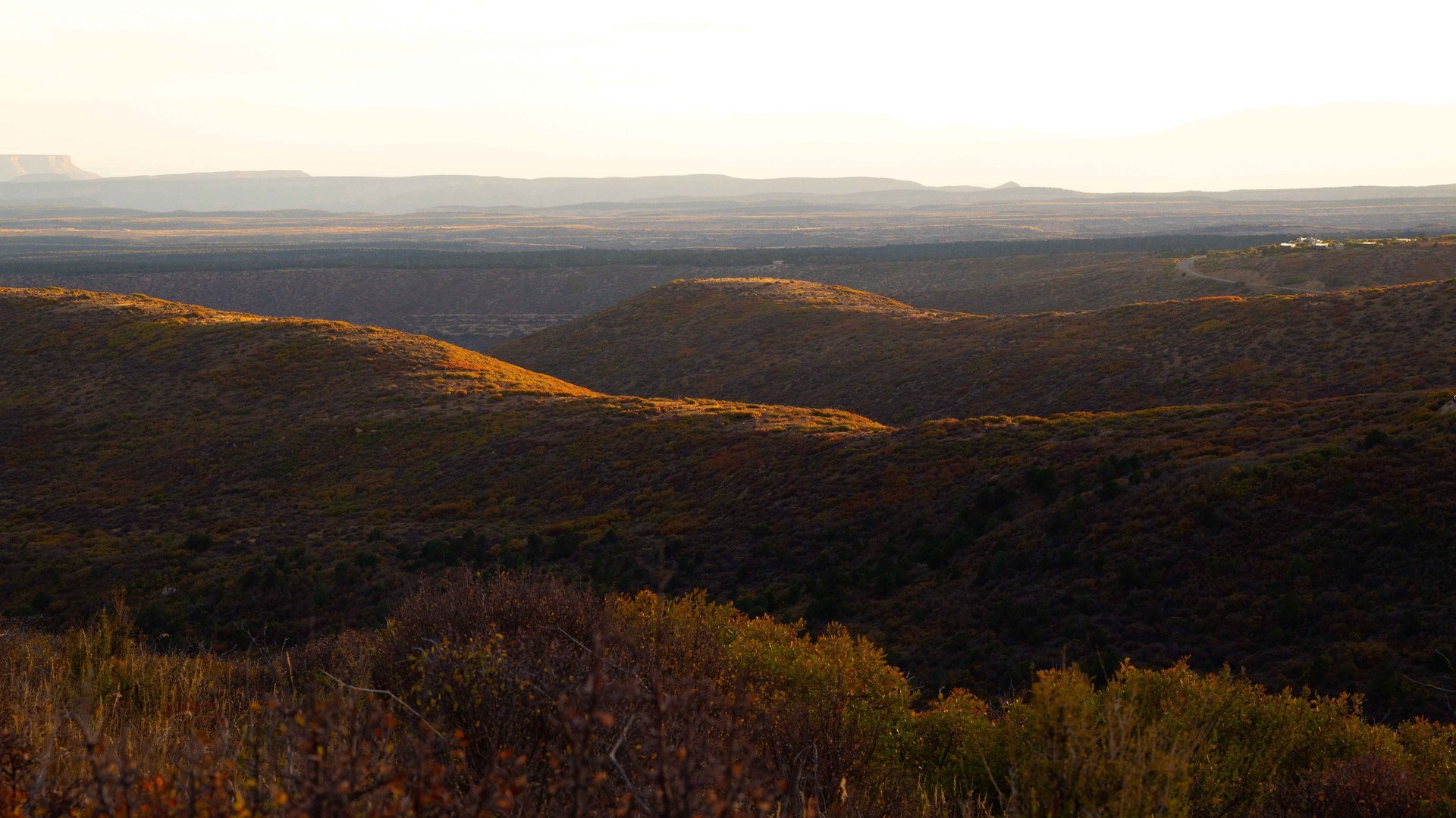
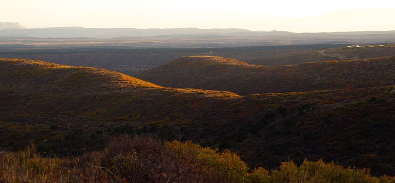
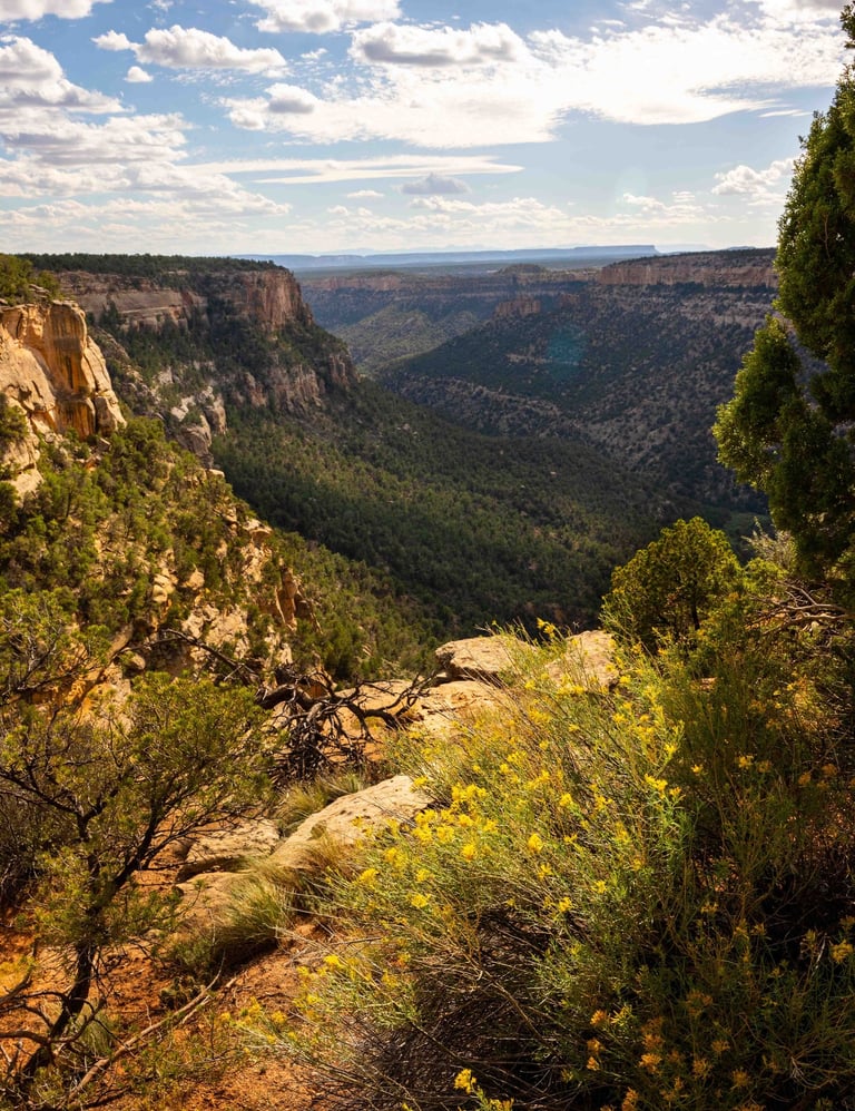
Stop 5 — Park Point Overlook
Most visitors to Mesa Verde never make it to Park Point.
It sits at the northern end of the park, away from the cliff dwelling loops, and there is no famous ruin waiting for you there. What there is: the highest point in the park at 8,572 feet, a fire lookout tower, and one of the longest unobstructed views in southwestern Colorado.
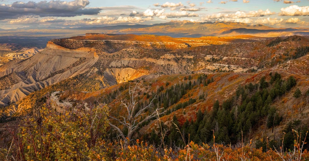
From here you can see beyond Cortez, eight miles out across the valley floor. On a clear evening you can trace the edge of the mesa all the way to where the land flattens into the high desert plain. The cliff dwellings are behind you. You cannot see them from here at all.
That felt significant.
We had spent the afternoon looking inward, into canyon walls, into alcoves, into rooms built by people who understood this landscape better than we ever will. Park Point turns you around. It faces you outward. And what you are looking at, standing there at nearly 9,000 feet as the sun drops behind the mesa, is the world as it has looked for a very long time.
The Ancestral Pueblo people would have known this view. Their mesa extended this far north. They farmed these slopes. They watched weather systems build over this valley. They made decisions here about when to plant and when to harvest, and read the sky the way people who depend on it learn to read it.
We stayed until the light was almost gone and the park roads were about to close. It was not the day we had planned. It was quieter than that, and somehow bigger.
A Note on the People Who Are Still Here
The Ancestral Pueblo people did not vanish. That is the story we told for a long time, but it is not the one their descendants tell.
Twenty-six tribes hold direct ancestral connection to Mesa Verde today. They are consulted on preservation decisions, research, and how the park's history is interpreted. This place has living owners. It always did.
Planning Your Visit
Getting there: Mesa Verde National Park is located near Cortez, Colorado, off Highway 160. Allow 45 minutes from the entrance gate to the main archaeological area on Chapin Mesa.
Tours: Book in advance at recreation.gov. Tickets open 14 days before your visit and sell out quickly in summer. Tours run May through October. All three major tours are strenuous and take place at 7,000 feet elevation.
Self-guided: The Mesa Top Loop and Cliff Palace Loop roads offer numerous overlooks accessible without tickets. The route we followed, Square Tower House, Sun Point, Sun Temple, Spruce Tree House, and Park Point, is entirely self-guided and takes roughly four hours if you arrive by 3 PM.
RV access: Smaller rigs can park at the visitor center. Wetherill Mesa road prohibits vehicles over 25 feet. Check current NPS conditions before arriving with a large rig.
Spruce Tree House: Closed since 2015 due to an unstable sandstone arch. Viewable from the overlook behind the Chapin Mesa Archeological Museum. No reopening date has been announced.
Watch the Full Episode
We hope to come back for the tours someday. We hope the arch above Spruce Tree House gets stabilized and the trail reopens. We hope whoever stands at Park Point in another 800 years finds something worth looking at.
Until then, see you out there.